Trotshill Farm
Introduction
The photograph on this page of Trotshill Farm by Andrew Darge as part of the Geograph project.
The Geograph project started in 2005 with the aim of publishing, organising and preserving representative images for every square kilometre of Great Britain, Ireland and the Isle of Man.

There are currently over 7.5m images from over 14,400 individuals and you can help contribute to the project by visiting https://www.geograph.org.uk
Trotshill Farm
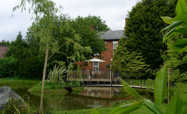
Image: © Andrew Darge Taken: 27 May 2009
Once clearly a prosperous farm on the outskirts of Worcester the house was for a time offices for the development of Warndon villages now a stylish home. The farm buildings have all been converted into attractive houses.
Images are licensed for reuse under creativecommons.org/licenses/by-sa/2.0
Image Location
Latitude
52.200398
Longitude
-2.169681