Woburn Sands Station
Introduction
The photograph on this page of Woburn Sands Station by Martin Addison as part of the Geograph project.
The Geograph project started in 2005 with the aim of publishing, organising and preserving representative images for every square kilometre of Great Britain, Ireland and the Isle of Man.

There are currently over 7.5m images from over 14,400 individuals and you can help contribute to the project by visiting https://www.geograph.org.uk
Woburn Sands Station
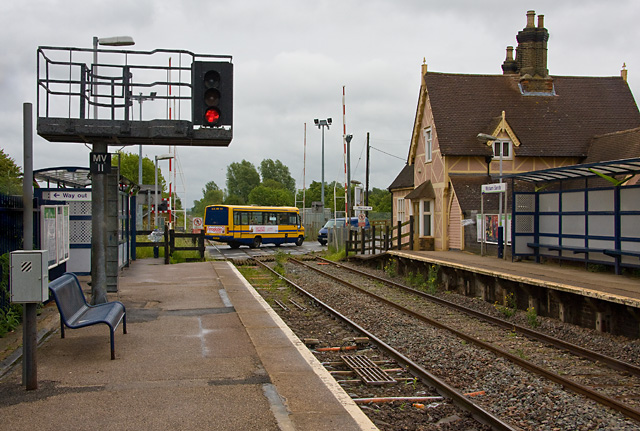
Image: © Martin Addison Taken: 27 May 2009
Looking towards Bedford. The station house on the left and the other station buildings are now available to let as business offices and meeting venues. Passengers are provided with bus shelters and steel seats. One of the local MK buses can be seen crossing the railway on the A4012, heading towards Woburn. The route is currently supported by contractors Wimpey as part of their involvement in a local affordable housing scheme.
Images are licensed for reuse under creativecommons.org/licenses/by-sa/2.0
Image Location
Latitude
52.018151
Longitude
-0.654157