Bonn Square and war memorial
Introduction
The photograph on this page of Bonn Square and war memorial by Natasha Ceridwen de Chroustchoff as part of the Geograph project.
The Geograph project started in 2005 with the aim of publishing, organising and preserving representative images for every square kilometre of Great Britain, Ireland and the Isle of Man.

There are currently over 7.5m images from over 14,400 individuals and you can help contribute to the project by visiting https://www.geograph.org.uk
Bonn Square and war memorial
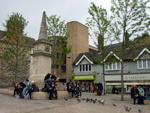
Image: © Natasha Ceridwen de Chroustchoff Taken: 13 May 2009
The square, previously a memorial garden, was given its name in honour of Oxford's first twin-town in 1974. It occupies the site of the graveyard of the church of St Peter-le-bailey which was demolished 100 years earlier in the interest of road-widening. This refurbished Bonn Square is the result of a major revamp in 2008 which revealed the existence of a number of old graves under the surface, and saw the felling, against great opposition, of 4 mature trees. (The old Bonn Square, which was stepped on different levels, was considered an eye-sore in the commercial heart of the city, being a magnet for drinkers and beggars.) The war memorial obelisk was erected in 1900 in memory of the men of the 2nd Oxfordshire Light Infantry who died in NW India in 1897-8 (and one who died in Uganda). For full details see http://www.headington.org.uk/oxon/burials/bonn_square/index.html
Images are licensed for reuse under creativecommons.org/licenses/by-sa/2.0
Image Location
Latitude
51.751987
Longitude
-1.260573