Ye Olde Anchor Inn, Upton-Upon-Severn
Introduction
The photograph on this page of Ye Olde Anchor Inn, Upton-Upon-Severn by Bob Embleton as part of the Geograph project.
The Geograph project started in 2005 with the aim of publishing, organising and preserving representative images for every square kilometre of Great Britain, Ireland and the Isle of Man.

There are currently over 7.5m images from over 14,400 individuals and you can help contribute to the project by visiting https://www.geograph.org.uk
Ye Olde Anchor Inn, Upton-Upon-Severn
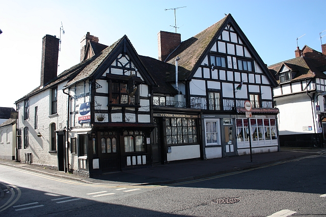
Image: © Bob Embleton Taken: 24 May 2009
On the corner of the old High Street (leading down to where the old bridge crossed the river) and the very narrow Dunns Lane.
Images are licensed for reuse under creativecommons.org/licenses/by-sa/2.0
Image Location


Leaflet Map data © OpenStreetMap
Latitude
52.063665
Longitude
-2.217006