Terling Windmill
Introduction
The photograph on this page of Terling Windmill by Trevor Harris as part of the Geograph project.
The Geograph project started in 2005 with the aim of publishing, organising and preserving representative images for every square kilometre of Great Britain, Ireland and the Isle of Man.

There are currently over 7.5m images from over 14,400 individuals and you can help contribute to the project by visiting https://www.geograph.org.uk
Terling Windmill
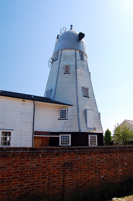
Image: © Trevor Harris Taken: 24 May 2009
The sailless windmill is now a private house. From this angle it is reminiscent of a giant dalek. It is clear from "Where is the Path" that parts of the mill straddle the line between this square and the one to the south.
Images are licensed for reuse under creativecommons.org/licenses/by-sa/2.0
Image Location
Latitude
51.805809
Longitude
0.557592