Fusion at Jackfield
Introduction
The photograph on this page of Fusion at Jackfield by Mike White as part of the Geograph project.
The Geograph project started in 2005 with the aim of publishing, organising and preserving representative images for every square kilometre of Great Britain, Ireland and the Isle of Man.

There are currently over 7.5m images from over 14,400 individuals and you can help contribute to the project by visiting https://www.geograph.org.uk
Fusion at Jackfield
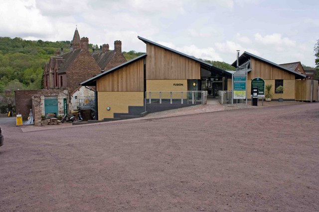
Image: © Mike White Taken: 10 May 2009
This new craft centre rivals the Maws craft centre at Image 500 metres further east. It's very nice, of course, but with units at Maws falling vacant, I wonder what the business case was to build a competitor. The older building behind it is the Jackfield Tile Museum.
Images are licensed for reuse under creativecommons.org/licenses/by-sa/2.0
Image Location
Latitude
52.623303
Longitude
-2.466462