Tarbolton Bailey From The Motte
Introduction
The photograph on this page of Tarbolton Bailey From The Motte by Mary and Angus Hogg as part of the Geograph project.
The Geograph project started in 2005 with the aim of publishing, organising and preserving representative images for every square kilometre of Great Britain, Ireland and the Isle of Man.

There are currently over 7.5m images from over 14,400 individuals and you can help contribute to the project by visiting https://www.geograph.org.uk
Tarbolton Bailey From The Motte
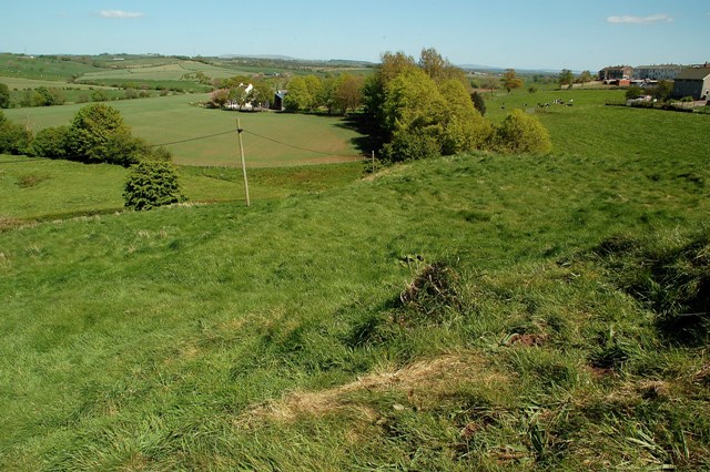
Image: © Mary and Angus Hogg Taken: 12 May 2009
The Motte at Tarbolton was set at the rear left-hand side of the Bailey. In this view, the foreground shows the edge of the Motte, where the lord's home would have been sited. Beyond this is a flat area with a rounded outline, which was the Bailey. This would have been the location of essential services for the house or tower on the Motte. Beyond the Bailey, the ground slopes away steeply to the current B744, tucked away out of sight in this view.
Images are licensed for reuse under creativecommons.org/licenses/by-sa/2.0
Image Location
Latitude
55.514937
Longitude
-4.484394