Tarbolton Motte From The Bailey
Introduction
The photograph on this page of Tarbolton Motte From The Bailey by Mary and Angus Hogg as part of the Geograph project.
The Geograph project started in 2005 with the aim of publishing, organising and preserving representative images for every square kilometre of Great Britain, Ireland and the Isle of Man.

There are currently over 7.5m images from over 14,400 individuals and you can help contribute to the project by visiting https://www.geograph.org.uk
Tarbolton Motte From The Bailey
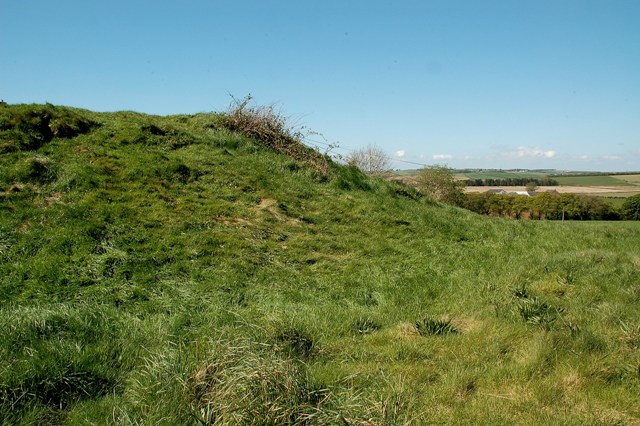
Image: © Mary and Angus Hogg Taken: 12 May 2009
The 12th century Motte at Tarbolton was surrounded on 3 sides by a Bailey. In this view, the sloping edge of the Motte is seen from the flat platform that was the Bailey. The Motte was the site of a wooden house or tower, which would be the home of the local lord. The Bailey was a surrounding base court containing the necessary services, such as stables, kitchens and workshops. Tarbolton Bailey would have been protected by a timber fence, combined with the naturally steep slope on 3 sides. (Source: The Castles of South-West Scotland", by Mike Salter)
Images are licensed for reuse under creativecommons.org/licenses/by-sa/2.0
Image Location
Latitude
55.514844
Longitude
-4.484546