Derelict House at the Crossroads
Introduction
The photograph on this page of Derelict House at the Crossroads by Anne Burgess as part of the Geograph project.
The Geograph project started in 2005 with the aim of publishing, organising and preserving representative images for every square kilometre of Great Britain, Ireland and the Isle of Man.

There are currently over 7.5m images from over 14,400 individuals and you can help contribute to the project by visiting https://www.geograph.org.uk
Derelict House at the Crossroads
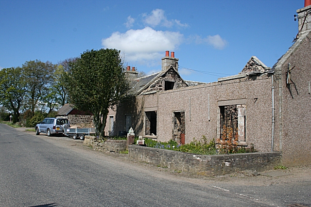
Image: © Anne Burgess Taken: 14 May 2009
This was originally the post office, and later it was a pub, until it closed down in the 1990s. Rumours for the reason for closure ranged from loss of licence to a threat from the Irish Republican Army. The building was burned down in 2007, along with a barn along the road, thought to be an act of vandalism. The pub sign was on a bracket, which still creaks, on the wall at top right. My thanks to Alan for information about it.
Images are licensed for reuse under creativecommons.org/licenses/by-sa/2.0
Image Location
Latitude
57.500731
Longitude
-2.286813