The south-eastern edge of Churchdown
Introduction
The photograph on this page of The south-eastern edge of Churchdown by Brian Robert Marshall as part of the Geograph project.
The Geograph project started in 2005 with the aim of publishing, organising and preserving representative images for every square kilometre of Great Britain, Ireland and the Isle of Man.

There are currently over 7.5m images from over 14,400 individuals and you can help contribute to the project by visiting https://www.geograph.org.uk
The south-eastern edge of Churchdown
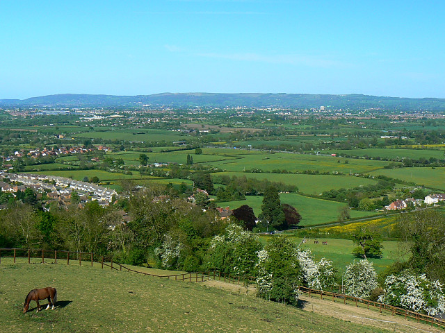
Image: © Brian Robert Marshall Taken: 11 May 2009
There are fine views from the churchyard of St Bartholomew's. The road leading away to the right of the image is Brockworth Road. It reaches the Gloucester suburb of that name after crossing the M5 and the A417.
Images are licensed for reuse under creativecommons.org/licenses/by-sa/2.0
Image Location
Latitude
51.87089
Longitude
-2.170324