Derelict building, Rock Road, Torquay
Introduction
The photograph on this page of Derelict building, Rock Road, Torquay by Derek Harper as part of the Geograph project.
The Geograph project started in 2005 with the aim of publishing, organising and preserving representative images for every square kilometre of Great Britain, Ireland and the Isle of Man.

There are currently over 7.5m images from over 14,400 individuals and you can help contribute to the project by visiting https://www.geograph.org.uk
Derelict building, Rock Road, Torquay
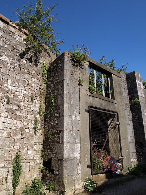
Image: © Derek Harper Taken: 8 May 2009
What remains of this building (which occupies a large site between Rock Road and Melville Street, above) looks pretty solid. But even the estate agent's notice seems to have given up on it. From a Torbay Council report: "The Methodist Chapel site between Melville Street and Rock Road ... has long been derelict. An imaginative development here, in keeping with the character and local distinctiveness of the conservation area, could be a first step in the badly needed regeneration of the sub-area."
Images are licensed for reuse under creativecommons.org/licenses/by-sa/2.0
Image Location
Latitude
50.464353
Longitude
-3.527529