St. Giles, South Mimms
Introduction
The photograph on this page of St. Giles, South Mimms by Martin Addison as part of the Geograph project.
The Geograph project started in 2005 with the aim of publishing, organising and preserving representative images for every square kilometre of Great Britain, Ireland and the Isle of Man.

There are currently over 7.5m images from over 14,400 individuals and you can help contribute to the project by visiting https://www.geograph.org.uk
St. Giles, South Mimms
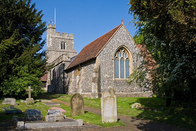
Image: © Martin Addison Taken: 10 May 2009
Parish Church of South Mimms, seen from within the churchyard. The church tower is at the Blanche Lane end. This view is from beside the footpath that leads from Blanche Lane to St. Albans Road, behind me. The church is a nice example of a flint-knapped building. The chancel dates to the 13th century and the tower to circa 1450 (info from British History online).
Images are licensed for reuse under creativecommons.org/licenses/by-sa/2.0
Image Location
Latitude
51.696194
Longitude
-0.232809