Sopley Camp
Introduction
The photograph on this page of Sopley Camp by Mike Faherty as part of the Geograph project.
The Geograph project started in 2005 with the aim of publishing, organising and preserving representative images for every square kilometre of Great Britain, Ireland and the Isle of Man.

There are currently over 7.5m images from over 14,400 individuals and you can help contribute to the project by visiting https://www.geograph.org.uk
Sopley Camp
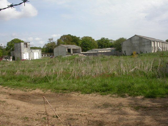
Image: © Mike Faherty Taken: 10 May 2009
Formerly the home of RAF Sopley, http://www.subbrit.org.uk/rsg/sites/s/sopley/index4.html , built 1952 to house radar apparatus, with accommodation for 450 personnel. The building to the left housed an emergency generator. The camp closed in 1974, and has subsequently been used to house the Household Cavalry for rest & recreation; to house Vietnamese refugees, and currently, renamed Merryfield Park, as a business park.http://archive.thisisdorset.net/2007/1/24/122448.html
Images are licensed for reuse under creativecommons.org/licenses/by-sa/2.0
Image Location
Latitude
50.780238
Longitude
-1.754141