Robertsbridge War Memorial
Introduction
The photograph on this page of Robertsbridge War Memorial by Simon Carey as part of the Geograph project.
The Geograph project started in 2005 with the aim of publishing, organising and preserving representative images for every square kilometre of Great Britain, Ireland and the Isle of Man.

There are currently over 7.5m images from over 14,400 individuals and you can help contribute to the project by visiting https://www.geograph.org.uk
Robertsbridge War Memorial
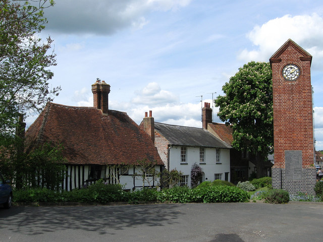
Image: © Simon Carey Taken: 3 May 2009
Actually a clock tower as opposed to a straightforward memorial, it was unveiled in 1926 and is opposite the George Inn on High Street. The house to the left is St Catherines which dates back to the 15th century and was named after a nearby well. The area in view is believed to be the original site of the first Cistercian Priory which was founded in 1176 and moved to the east of village in 1210.
Images are licensed for reuse under creativecommons.org/licenses/by-sa/2.0
Image Location
Latitude
50.9845
Longitude
0.474317