Roden Street, Belfast
Introduction
The photograph on this page of Roden Street, Belfast by Albert Bridge as part of the Geograph project.
The Geograph project started in 2005 with the aim of publishing, organising and preserving representative images for every square kilometre of Great Britain, Ireland and the Isle of Man.

There are currently over 7.5m images from over 14,400 individuals and you can help contribute to the project by visiting https://www.geograph.org.uk
Roden Street, Belfast
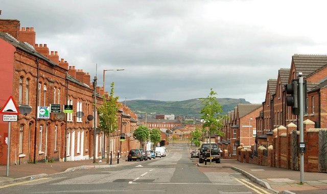
Image: © Albert Bridge Taken: 3 May 2009
Built around the mid-19th century as a short street off the Grosvenor Road, Roden Street eventually became a long street running through to the Donegall Road. Bisected by the building of the Westlink it was finally cut in two in 2008 when the rebuilding of the Westlink Image was completed. There is now no through road for motor vehicles. Pedestrians can still cross by a footbridge Image This end (at the Donegall Road) has been redeveloped but still includes a few traditional terrace houses (left).
Images are licensed for reuse under creativecommons.org/licenses/by-sa/2.0
Image Location
Latitude
54.590543
Longitude
-5.948829