Looking North From The Monument
Introduction
The photograph on this page of Looking North From The Monument by Peter Trimming as part of the Geograph project.
The Geograph project started in 2005 with the aim of publishing, organising and preserving representative images for every square kilometre of Great Britain, Ireland and the Isle of Man.

There are currently over 7.5m images from over 14,400 individuals and you can help contribute to the project by visiting https://www.geograph.org.uk
Looking North From The Monument
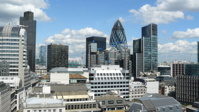
Image: © Peter Trimming Taken: 1 May 2009
A wide variety of building styles in evidence, including the distinctive "Gherkin" (30 St Mary Axe). As a comparison, The Monument stands at 202 feet (61 metres) and the "Gherkin" 591 feet (180 metres). The buildings closest to camera are in this gridsquare, but most of the buildings are in the adjacent gridsquare.
Images are licensed for reuse under creativecommons.org/licenses/by-sa/2.0
Image Location


Leaflet Map data © OpenStreetMap
Latitude
51.512249
Longitude
-0.082907