Back gardens in Spetisbury
Introduction
The photograph on this page of Back gardens in Spetisbury by John Palmer as part of the Geograph project.
The Geograph project started in 2005 with the aim of publishing, organising and preserving representative images for every square kilometre of Great Britain, Ireland and the Isle of Man.

There are currently over 7.5m images from over 14,400 individuals and you can help contribute to the project by visiting https://www.geograph.org.uk
Back gardens in Spetisbury
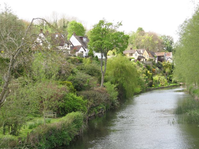
Image: © John Palmer Taken: 26 Apr 2009
The steep back gardens tumbling down to the Stour, taken from Crawford Bridge. This delightful scene makes up for the busy A350 at the front of the houses. The River Stour can rise 2.6 metres in a flood, all these houses should be safe. Spetisbury village is long and thin, jammed between a hill and the river, and the road takes up some of the space available.
Images are licensed for reuse under creativecommons.org/licenses/by-sa/2.0
Image Location


Leaflet Map data © OpenStreetMap
Latitude
50.818025
Longitude
-2.118479