River Derwent and the Flour Mill, Norton
Introduction
The photograph on this page of River Derwent and the Flour Mill, Norton by Peter Church as part of the Geograph project.
The Geograph project started in 2005 with the aim of publishing, organising and preserving representative images for every square kilometre of Great Britain, Ireland and the Isle of Man.

There are currently over 7.5m images from over 14,400 individuals and you can help contribute to the project by visiting https://www.geograph.org.uk
River Derwent and the Flour Mill, Norton
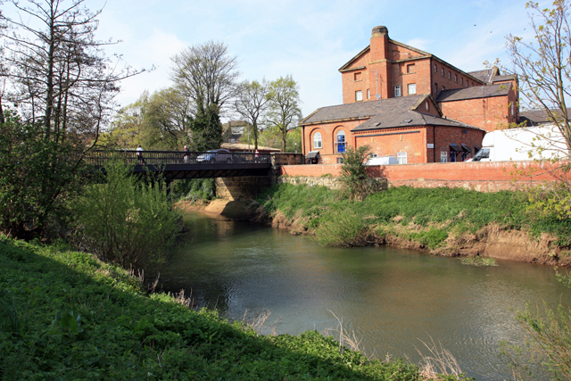
Image: © Peter Church Taken: 24 Apr 2009
The river is crossed here by Railway Street Bridge, and Railway Street leads south to the Railway Station and north to the Town Centre. The flour mill is no longer used as a mill. The river is the river Derwent, flowing away from the photographer. The next bridge in this direction is the suspension bridge at Low Hutton.
Images are licensed for reuse under creativecommons.org/licenses/by-sa/2.0
Image Location
Latitude
54.133331
Longitude
-0.797033