Sidings south of Corkickle station
Introduction
The photograph on this page of Sidings south of Corkickle station by Stephen Craven as part of the Geograph project.
The Geograph project started in 2005 with the aim of publishing, organising and preserving representative images for every square kilometre of Great Britain, Ireland and the Isle of Man.

There are currently over 7.5m images from over 14,400 individuals and you can help contribute to the project by visiting https://www.geograph.org.uk
Sidings south of Corkickle station
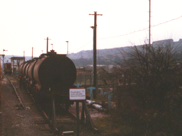
Image: © Stephen Craven Taken: 28 Mar 1988
This view, taken from a passing train many years ago, was hard to pin down on the map, as the sidings (and Corkickle No.1 signalbox in the background) have long since been removed. The clue came in a railway track diagram ["British Rail Track Diagrams - No 4 London Midland Region", Quail publishing, 1990] that showed the several sidings and two signalboxes in the area, along with their chainage (distance along the line) - No. 1 box being 43 chains / 865m south of Corkickle tunnel.
Images are licensed for reuse under creativecommons.org/licenses/by-sa/2.0
Image Location
Latitude
54.534352
Longitude
-3.578789