Pound Farm House
Introduction
The photograph on this page of Pound Farm House by Martin Addison as part of the Geograph project.
The Geograph project started in 2005 with the aim of publishing, organising and preserving representative images for every square kilometre of Great Britain, Ireland and the Isle of Man.

There are currently over 7.5m images from over 14,400 individuals and you can help contribute to the project by visiting https://www.geograph.org.uk
Pound Farm House
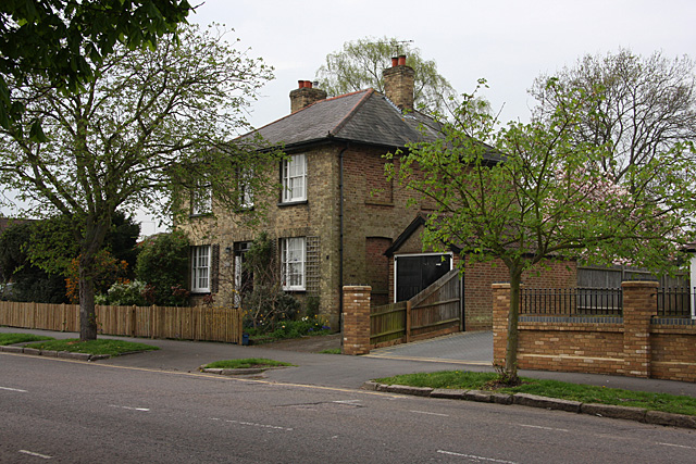
Image: © Martin Addison Taken: 14 Apr 2009
Located on Baker Street, Potters Bar. The house probably takes its name from the Manorial Pound which was located at the junction of Mutton Lane and Darkes Lane, around 100 yards away. The house is interesting in that it appears to have once had windows all along the side as well as the front. Whether these were windows that were removed due to the window tax, or just a fashion statement I don't know. Whether it was ever actually a farmhouse is also unconfirmed.
Images are licensed for reuse under creativecommons.org/licenses/by-sa/2.0
Image Location
Latitude
51.694343
Longitude
-0.194508