Capel Libanus Chapel
Introduction
The photograph on this page of Capel Libanus Chapel by Eric Jones as part of the Geograph project.
The Geograph project started in 2005 with the aim of publishing, organising and preserving representative images for every square kilometre of Great Britain, Ireland and the Isle of Man.

There are currently over 7.5m images from over 14,400 individuals and you can help contribute to the project by visiting https://www.geograph.org.uk
Capel Libanus Chapel
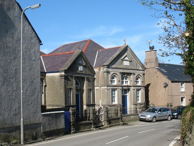
Image: © Eric Jones Taken: 18 Apr 2009
The Calvinist Libanus Chapel complex (the name "Libanus" is Welsh for Lebanon) consists, from left to right, of the chapel house, the vestry and the main chapel. The present chapel dates from 1903. Calvinistic Methodism in the area however dates back to 1815 and with the ultra-Calvinist and High Tory, John Elias as its minister ( his wife, Elizabeth Broadhead from Cemlyn, also kept a shop on the square at Llanfechell) the village soon became a hot bed of Calvinism and teetotalism. Following Elizabeth's death and his remarriage to the Dowager Lady Bulkeley in 1839, John Elias moved from the village to live at Llangefni. http://yba.llgc.org.uk/en/s-ELIA-JOH-1774.html
Images are licensed for reuse under creativecommons.org/licenses/by-sa/2.0
Image Location
Latitude
53.392539
Longitude
-4.454837