Garvaghy Parish Church, Waringsford
Introduction
The photograph on this page of Garvaghy Parish Church, Waringsford by Dean Molyneaux as part of the Geograph project.
The Geograph project started in 2005 with the aim of publishing, organising and preserving representative images for every square kilometre of Great Britain, Ireland and the Isle of Man.

There are currently over 7.5m images from over 14,400 individuals and you can help contribute to the project by visiting https://www.geograph.org.uk
Garvaghy Parish Church, Waringsford
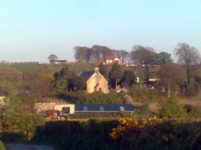
Image: © Dean Molyneaux Taken: 19 Apr 2009
Garvaghy Parish Church, seen here from the Fedney Hill Road, was built in 1699 and thoroughly renovated in 1780. The parish serves Waringsford and its surroundings, however it was united with St. John's Parish Church in Dromara, in 1885. It is sited on the appropriately named Garvaghy Church Road, south of Waringsford in Fedney townland. Garvaghy Presbyterian Church is sited a few yards to the east.
Images are licensed for reuse under creativecommons.org/licenses/by-sa/2.0
Image Location
Latitude
54.357967
Longitude
-6.117203