Parish boundary marks in Lombard Court
Introduction
The photograph on this page of Parish boundary marks in Lombard Court by Basher Eyre as part of the Geograph project.
The Geograph project started in 2005 with the aim of publishing, organising and preserving representative images for every square kilometre of Great Britain, Ireland and the Isle of Man.

There are currently over 7.5m images from over 14,400 individuals and you can help contribute to the project by visiting https://www.geograph.org.uk
Parish boundary marks in Lombard Court
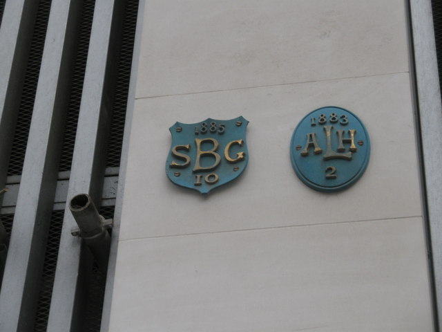
Image: © Basher Eyre Taken: 17 Apr 2009
I had not seen these before. They are for All Hallows, Lombard Street and St Benet Gracechurch Street, now both demolished. Taken on the Pepys Walk, a circular walk around the City of London and the South bank starting and finishing at St Paul's Cathedral.
Images are licensed for reuse under creativecommons.org/licenses/by-sa/2.0
Image Location
Latitude
51.512557
Longitude
-0.0852