Hemel Hempstead: The Nicky Line
Introduction
The photograph on this page of Hemel Hempstead: The Nicky Line by Nigel Cox as part of the Geograph project.
The Geograph project started in 2005 with the aim of publishing, organising and preserving representative images for every square kilometre of Great Britain, Ireland and the Isle of Man.

There are currently over 7.5m images from over 14,400 individuals and you can help contribute to the project by visiting https://www.geograph.org.uk
Hemel Hempstead: The Nicky Line
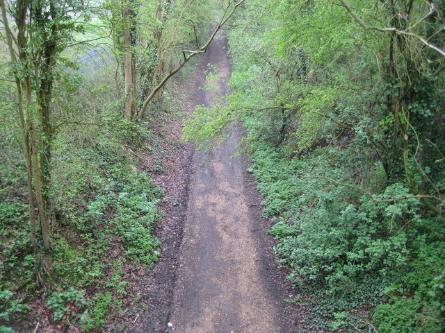
Image: © Nigel Cox Taken: 12 Apr 2009
Viewed from Image this is the trackbed of the dismantled Hemel Hempstead to Harpenden railway (The Nicky Line), completed in 1877. Passenger services ceased in 1947 and the track was lifted in the late 1950s. The trackbed now forms a section of the National Cycle Network Route 57.
Images are licensed for reuse under creativecommons.org/licenses/by-sa/2.0
Image Location
Latitude
51.775578
Longitude
-0.43067