Freedom Road Junction, Lower Walkley, Sheffield
Introduction
The photograph on this page of Freedom Road Junction, Lower Walkley, Sheffield by Terry Robinson as part of the Geograph project.
The Geograph project started in 2005 with the aim of publishing, organising and preserving representative images for every square kilometre of Great Britain, Ireland and the Isle of Man.

There are currently over 7.5m images from over 14,400 individuals and you can help contribute to the project by visiting https://www.geograph.org.uk
Freedom Road Junction, Lower Walkley, Sheffield
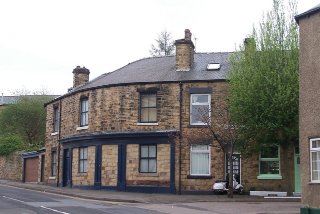
Image: © Terry Robinson Taken: 14 Apr 2009
This building, on the corner of Walkley Road (in the foreground) and Freedom Road (off to the right) was originally the Royal Oak Public House. The entrance to the Pub being the bricked up section, in the centre between the two windows.
Images are licensed for reuse under creativecommons.org/licenses/by-sa/2.0
Image Location
Latitude
53.39524
Longitude
-1.496635