High Road, Chilwell Nos. 38 and 40
Introduction
The photograph on this page of High Road, Chilwell Nos. 38 and 40 by David Lally as part of the Geograph project.
The Geograph project started in 2005 with the aim of publishing, organising and preserving representative images for every square kilometre of Great Britain, Ireland and the Isle of Man.

There are currently over 7.5m images from over 14,400 individuals and you can help contribute to the project by visiting https://www.geograph.org.uk
High Road, Chilwell Nos. 38 and 40
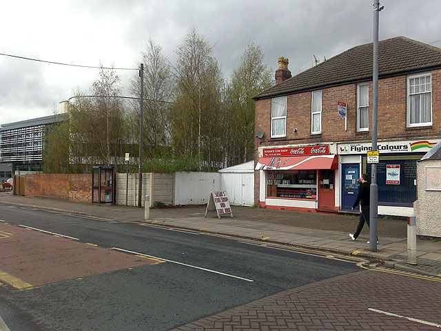
Image: © David Lally Taken: 9 Apr 2009
The plans of the proposed NET extension say that No. 38 will be demolished to make way for the tram tracks. I can't see that they will leave No. 40 , the right-hand one of this pair of semis, standing. The driving school business which occupied No. 40 has already moved.
Images are licensed for reuse under creativecommons.org/licenses/by-sa/2.0
Image Location
Latitude
52.921842
Longitude
-1.222809