Carnon River near Point Mills
Introduction
The photograph on this page of Carnon River near Point Mills by John Gibson as part of the Geograph project.
The Geograph project started in 2005 with the aim of publishing, organising and preserving representative images for every square kilometre of Great Britain, Ireland and the Isle of Man.

There are currently over 7.5m images from over 14,400 individuals and you can help contribute to the project by visiting https://www.geograph.org.uk
Carnon River near Point Mills
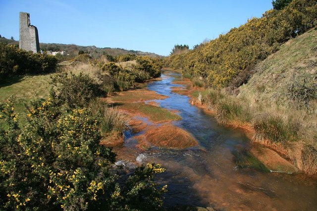
Image: © John Gibson Taken: 17 Mar 2009
Pollution from mine waters is clearly visible at this point in the Carnon River. To the left is the stump of the chimney at the Point Mills Arsenic Refinery. The chimney was a prominent local landmark until it was hit by lightning in December 1990.
Images are licensed for reuse under creativecommons.org/licenses/by-sa/2.0
Image Location
Latitude
50.229589
Longitude
-5.12666