Eglwys Tyfrydog Sant, Llandyfrydog
Introduction
The photograph on this page of Eglwys Tyfrydog Sant, Llandyfrydog by Eric Jones as part of the Geograph project.
The Geograph project started in 2005 with the aim of publishing, organising and preserving representative images for every square kilometre of Great Britain, Ireland and the Isle of Man.

There are currently over 7.5m images from over 14,400 individuals and you can help contribute to the project by visiting https://www.geograph.org.uk
Eglwys Tyfrydog Sant, Llandyfrydog
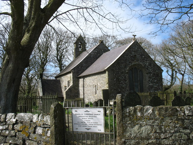
Image: © Eric Jones Taken: 28 Mar 2009
The church which dates from the 14th and 15thC with minor later additions, occupies a site which has had a Christian church since the Dark Ages. It is located in what feels like a remote part of the island with little settlement apart from scattered farmsteads. The hamlet of Llandyfrydog shows the effects of depopulation, with many ruined houses. The church, approached by winding lanes, stands in a wooded hollow.
Images are licensed for reuse under creativecommons.org/licenses/by-sa/2.0
Image Location


Leaflet Map data © OpenStreetMap
Latitude
53.341998
Longitude
-4.339108