Rainbow's End, Enfield
Introduction
The photograph on this page of Rainbow's End, Enfield by Christine Matthews as part of the Geograph project.
The Geograph project started in 2005 with the aim of publishing, organising and preserving representative images for every square kilometre of Great Britain, Ireland and the Isle of Man.

There are currently over 7.5m images from over 14,400 individuals and you can help contribute to the project by visiting https://www.geograph.org.uk
Rainbow's End, Enfield
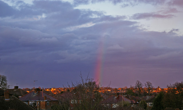
Image: © Christine Matthews Taken: 27 Mar 2009
Looking across towards Enfield from close to the boundary of the old Borough of Southgate and Borough of Enfield, with the brightly coloured sunset illuminating the houses and the rainbow finishing in the centre. The phenomenon of a darker sky on the outer side of the rainbow is very noticeable in this image.
Images are licensed for reuse under creativecommons.org/licenses/by-sa/2.0
Image Location


Leaflet Map data © OpenStreetMap
Latitude
51.647123
Longitude
-0.121019