Raunds war memorial
Introduction
The photograph on this page of Raunds war memorial by Natasha Ceridwen de Chroustchoff as part of the Geograph project.
The Geograph project started in 2005 with the aim of publishing, organising and preserving representative images for every square kilometre of Great Britain, Ireland and the Isle of Man.

There are currently over 7.5m images from over 14,400 individuals and you can help contribute to the project by visiting https://www.geograph.org.uk
Raunds war memorial
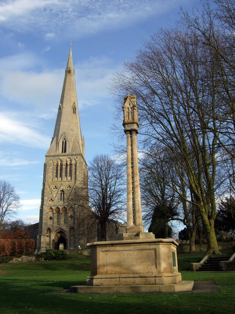
Image: © Natasha Ceridwen de Chroustchoff Taken: 2 Mar 2009
The memorial was originally in the Market Square and dedicated to the memory of the servicemen killed in WW1 but it was moved to its present location in front of St Peter's church in 1950 when the names of the WW2 fallen were added.
Images are licensed for reuse under creativecommons.org/licenses/by-sa/2.0
Image Location
Latitude
52.346958
Longitude
-0.533691