Bournemouth: Wellington Road underpass
Introduction
The photograph on this page of Bournemouth: Wellington Road underpass by Chris Downer as part of the Geograph project.
The Geograph project started in 2005 with the aim of publishing, organising and preserving representative images for every square kilometre of Great Britain, Ireland and the Isle of Man.

There are currently over 7.5m images from over 14,400 individuals and you can help contribute to the project by visiting https://www.geograph.org.uk
Bournemouth: Wellington Road underpass
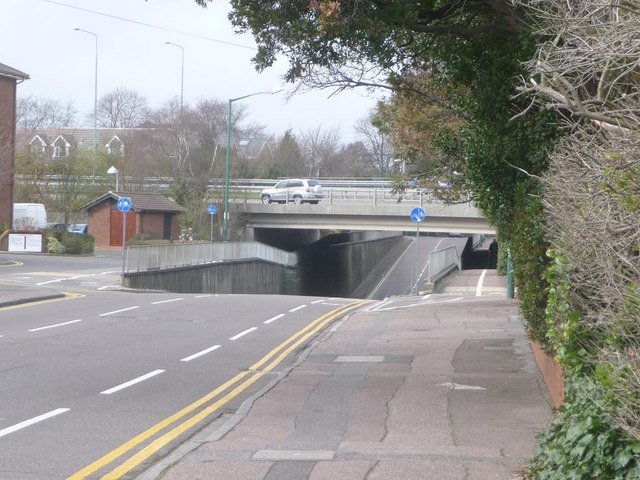
Image: © Chris Downer Taken: 26 Mar 2009
When the main A338 Wessex Way was built in the 1970s, only Wellington Road was retained as a crossing point for vehicles; the parallel roads to the north have been severed. Here we see where the carriageway of Wellington Road has been lowered to allow the dual carriageway to pass over without the need for a high viaduct. The camber of the main road can also be discerned from this point – with the far carriageway virtually visible beyond the nearer one, despite the fact that we are clearly below that level.
Images are licensed for reuse under creativecommons.org/licenses/by-sa/2.0
Image Location
Latitude
50.72853
Longitude
-1.863933