Annadale Flats, Belfast
Introduction
The photograph on this page of Annadale Flats, Belfast by Albert Bridge as part of the Geograph project.
The Geograph project started in 2005 with the aim of publishing, organising and preserving representative images for every square kilometre of Great Britain, Ireland and the Isle of Man.

There are currently over 7.5m images from over 14,400 individuals and you can help contribute to the project by visiting https://www.geograph.org.uk
Annadale Flats, Belfast
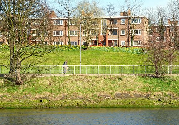
Image: © Albert Bridge Taken: 23 Mar 2009
In the years after the end of WWII there was a movement (or, perhaps, even a fad) in public sector housing for flat roofs and geometrically straight lines. Annadale Flats remains one of the greats of that era although it took the movement in a different direction by spreading the properties along the embankment by the Lagan when others were being built in as clusters in estates. Now a remarkable example of a period when economic expansion and a brave new world beckoned. Incidentally the name “Annadale” is said to come from the earlier estate on the site – that of Lady Anne Mornington, mother of the Duke of Wellington and is thought to be a variation of her name to “Annadale” “Anne's Dale”.
Images are licensed for reuse under creativecommons.org/licenses/by-sa/2.0
Image Location
Latitude
54.578836
Longitude
-5.926216