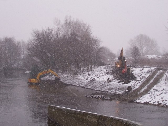
Dredging the Don in the snow at Jordan
Introduction
The photograph on this page of Dredging the Don in the snow at Jordan by Martin Speck as part of the Geograph project.
The Geograph project started in 2005 with the aim of publishing, organising and preserving representative images for every square kilometre of Great Britain, Ireland and the Isle of Man.
There are currently over 7.5m images from over 14,400 individuals and you can help contribute to the project by visiting https://www.geograph.org.uk

Image: © Martin Speck Taken: 2 Feb 2009
Three diggers carry out Environment Agency work to improve the river flow below the weir at Jordan. This is part of a strategy to lessen the chances of the Don flooding Sheffield again. The concrete wall in the river separates the Don (right) from the Blackburn Meadows sewage works outfall (left). The OS 1:50000 map, shown on Geograph calls this area Jordon, but the OS 1:25000 Explorer map and Get-a-map calls it Jordan.

