Bunter Sandstone section
Introduction
The photograph on this page of Bunter Sandstone section by Alan Murray-Rust as part of the Geograph project.
The Geograph project started in 2005 with the aim of publishing, organising and preserving representative images for every square kilometre of Great Britain, Ireland and the Isle of Man.

There are currently over 7.5m images from over 14,400 individuals and you can help contribute to the project by visiting https://www.geograph.org.uk
Bunter Sandstone section
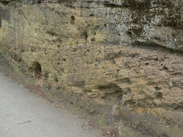
Image: © Alan Murray-Rust Taken: 15 Mar 2009
Where Hucknall Road drops down from the crossing with Perry Road, the soft stone making it easy to create a cutting. Note the various sedimentary layers and planes, and the considerable quantity of embedded rounded pebbles. The section is around 1.6 metres high.
Images are licensed for reuse under creativecommons.org/licenses/by-sa/2.0
Image Location
Latitude
52.984058
Longitude
-1.158091