The former Western Road Secondary Modern School, Crookes
Introduction
The photograph on this page of The former Western Road Secondary Modern School, Crookes by Dave Hitchborne as part of the Geograph project.
The Geograph project started in 2005 with the aim of publishing, organising and preserving representative images for every square kilometre of Great Britain, Ireland and the Isle of Man.

There are currently over 7.5m images from over 14,400 individuals and you can help contribute to the project by visiting https://www.geograph.org.uk
The former Western Road Secondary Modern School, Crookes
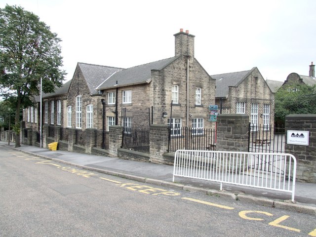
Image: © Dave Hitchborne Taken: 26 Aug 2008
The junior school block. I once reached these school gates only to be badly bitten by a dog. Someone in school quickly patched me up and so I failed to miss any lessons. Not much has changed since the ‘50s; white railing at the road’s edge, yellow bin, writing on the road, the school sign has been added and all that’s missing are the gas lamps. In the background can be seen the infant’s school. The school is now known as Westways.
Images are licensed for reuse under creativecommons.org/licenses/by-sa/2.0
Image Location
Latitude
53.385779
Longitude
-1.501888