Level crossing, Coleraine station (3)
Introduction
The photograph on this page of Level crossing, Coleraine station (3) by Albert Bridge as part of the Geograph project.
The Geograph project started in 2005 with the aim of publishing, organising and preserving representative images for every square kilometre of Great Britain, Ireland and the Isle of Man.

There are currently over 7.5m images from over 14,400 individuals and you can help contribute to the project by visiting https://www.geograph.org.uk
Level crossing, Coleraine station (3)
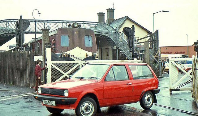
Image: © Albert Bridge Taken: 4 Jun 1983
See Image The view across the level crossing, from the Bushmills Road side. The signals, gates and footbridge (and probably the Polo too) are now history Image Continue to Image
Images are licensed for reuse under creativecommons.org/licenses/by-sa/2.0
Image Location
Latitude
55.134789
Longitude
-6.662709