
Low Wood Rapid on the Swale
Introduction
The photograph on this page of Low Wood Rapid on the Swale by Andy Waddington as part of the Geograph project.
The Geograph project started in 2005 with the aim of publishing, organising and preserving representative images for every square kilometre of Great Britain, Ireland and the Isle of Man.

There are currently over 7.5m images from over 14,400 individuals and you can help contribute to the project by visiting https://www.geograph.org.uk
Low Wood Rapid on the Swale
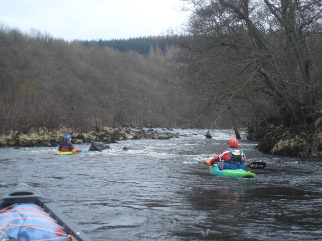
Image: © Andy Waddington Taken: 19 Mar 2006
This rapid starts with a wide shallow area (there are stepping stones visible on aerial photos although these are not seen by canoeists if the river is at an adequate level). Paddlers then try to get river left to the deeper channel, whilst avoiding overhanging trees on the left bank, and the central rock at the bottom. The photo shows a depressingly low level (the River Swale rises and falls quickly and is hard to catch at a good level). With a bit more water, a playwave forms at the bottom of the rapid, but then at high levels washes out completely.
Images are licensed for reuse under creativecommons.org/licenses/by-sa/2.0
Image Location

Latitude
54.374994
Longitude
-1.860498