Cromwell's Wall And Miller's Folly
Introduction
The photograph on this page of Cromwell's Wall And Miller's Folly by Mary and Angus Hogg as part of the Geograph project.
The Geograph project started in 2005 with the aim of publishing, organising and preserving representative images for every square kilometre of Great Britain, Ireland and the Isle of Man.

There are currently over 7.5m images from over 14,400 individuals and you can help contribute to the project by visiting https://www.geograph.org.uk
Cromwell's Wall And Miller's Folly
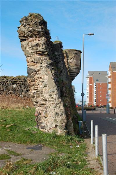
Image: © Mary and Angus Hogg Taken: 6 Mar 2009
The old wall is a surviving section of the fort built here by the Cromwellian government in 1652-3. The small turret was added much later by a local businessman.
Images are licensed for reuse under creativecommons.org/licenses/by-sa/2.0
Image Location
Latitude
55.465812
Longitude
-4.636986