Mytton Dingle
Introduction
The photograph on this page of Mytton Dingle by Trevor Rickard as part of the Geograph project.
The Geograph project started in 2005 with the aim of publishing, organising and preserving representative images for every square kilometre of Great Britain, Ireland and the Isle of Man.

There are currently over 7.5m images from over 14,400 individuals and you can help contribute to the project by visiting https://www.geograph.org.uk
Mytton Dingle
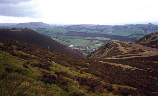
Image: © Trevor Rickard Taken: Unknown
From the top of the dingle looking west down to Stiperstones village. Buxton Wood on the small hill beyond the village. Corndon Hill in the distance on the left. Evidence of old mine spoil tips all around this area.
Images are licensed for reuse under creativecommons.org/licenses/by-sa/2.0
Image Location
Latitude
52.597684
Longitude
-2.936566