Holly House
Introduction
The photograph on this page of Holly House by Colin Smith as part of the Geograph project.
The Geograph project started in 2005 with the aim of publishing, organising and preserving representative images for every square kilometre of Great Britain, Ireland and the Isle of Man.

There are currently over 7.5m images from over 14,400 individuals and you can help contribute to the project by visiting https://www.geograph.org.uk
Holly House
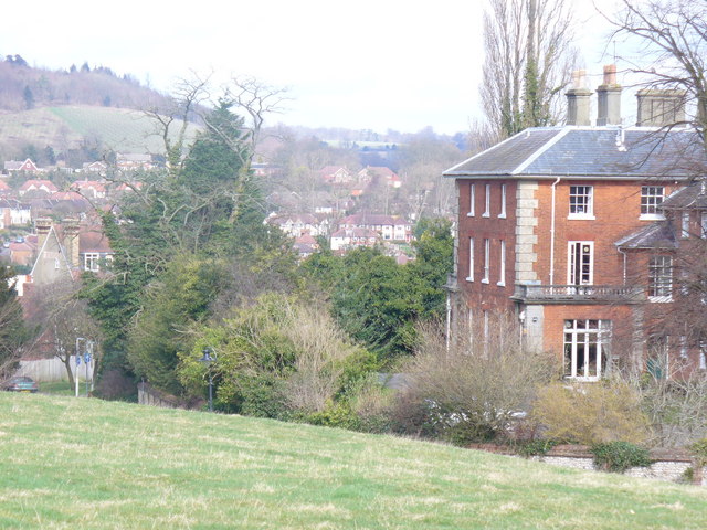
Image: © Colin Smith Taken: 7 Mar 2009
One of the many large Victorian buildings on Rose Hill. The view here to the north, across Dorking, takes in Ranmore Common and the Mole Gap.
Images are licensed for reuse under creativecommons.org/licenses/by-sa/2.0
Image Location
Latitude
51.229639
Longitude
-0.331579