Approach to The Three Bridges - looking southwards
Introduction
The photograph on this page of Approach to The Three Bridges - looking southwards by J Taylor as part of the Geograph project.
The Geograph project started in 2005 with the aim of publishing, organising and preserving representative images for every square kilometre of Great Britain, Ireland and the Isle of Man.

There are currently over 7.5m images from over 14,400 individuals and you can help contribute to the project by visiting https://www.geograph.org.uk
Approach to The Three Bridges - looking southwards
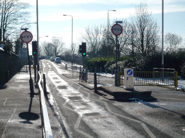
Image: © J Taylor Taken: 4 Feb 2009
The Three Bridges is a unique transport intersection, designed and built by Isambard Kingdom Brunel. It was to be his last project before he died on 15th September 1859 just two months after its completion. The correct name for it should be Windmill Bridge - named after the Southall Mill, which stood on the south-western side of the original canal bridge which was first built in the 1790's when the canal was cut. J.M.W. Turner painted this windmill in 1806. http://commons.wikimedia.org/wiki/File:Joseph_Mallord_William_Turner_014.jpg Known locally as Three Bridges, the name is a misnomer as there are in fact only two bridges - the road bridge over the canal and the canal bridge over the railway. The canal is conveyed through an 8 ft cast-iron trough over the railway, with the road on a brick & cast-iron girder bridge above. The Three Bridges was constructed as a result of the Brentford Branch line being built to connect the Great Western Railway at Southall to the docks at Brentford. Which was opened in July 1859. Brunel chose the location for the Three Bridges intersection where the canal was already crossed by Windmill Lane. The Three Bridges has been designated a Scheduled Ancient Monument by English Heritage. There is a 3 ton weight and 6' 6" width restrictions on the road bridge.
Images are licensed for reuse under creativecommons.org/licenses/by-sa/2.0
Image Location
Latitude
51.505312
Longitude
-0.355679