Grave Stones
Introduction
The photograph on this page of Grave Stones by PAUL FARMER as part of the Geograph project.
The Geograph project started in 2005 with the aim of publishing, organising and preserving representative images for every square kilometre of Great Britain, Ireland and the Isle of Man.

There are currently over 7.5m images from over 14,400 individuals and you can help contribute to the project by visiting https://www.geograph.org.uk
Grave Stones
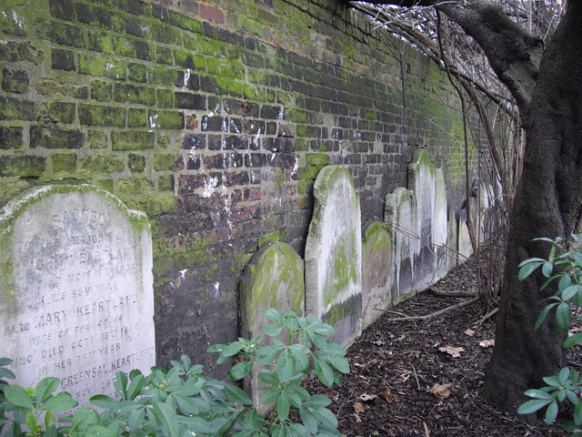
Image: © PAUL FARMER Taken: 28 Feb 2009
Lambeth High Street Recreation Ground, these stones were moved to the edge of the park when it was reopened as a public garden in 1884. The graveyard ceased being used in 1853-the stone to the left is dated 1850.
Images are licensed for reuse under creativecommons.org/licenses/by-sa/2.0
Image Location
Latitude
51.493055
Longitude
-0.119294