Archway Road
Introduction
The photograph on this page of Archway Road by Martin Addison as part of the Geograph project.
The Geograph project started in 2005 with the aim of publishing, organising and preserving representative images for every square kilometre of Great Britain, Ireland and the Isle of Man.

There are currently over 7.5m images from over 14,400 individuals and you can help contribute to the project by visiting https://www.geograph.org.uk
Archway Road
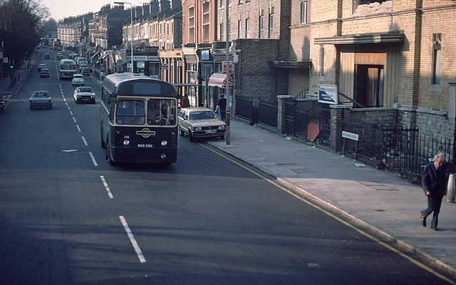
Image: © Martin Addison Taken: 12 Apr 1980
Taken from the top deck of a Barnet bound 263, looking towards Highgate. The building on the immediate right was Archway Road Baptist Church. It had closed by 1941. Highgate District Synagogue took over the building in 1950, refacing it with yellow bricks. It was damaged by fire in 1975 resulting in its derelict condition in this photo. The bus passing south is ex-London Transport RF394. Withdrawn and now making a living with another operator. Behind is a United Counties coach en-route to Kings Cross and a southbound 263 can be seen in the distance
Images are licensed for reuse under creativecommons.org/licenses/by-sa/2.0
Image Location
Latitude
51.57379
Longitude
-0.140785