Flood Level at Pensford 10th and 11th July 1968
Introduction
The photograph on this page of Flood Level at Pensford 10th and 11th July 1968 by Rick Crowley as part of the Geograph project.
The Geograph project started in 2005 with the aim of publishing, organising and preserving representative images for every square kilometre of Great Britain, Ireland and the Isle of Man.

There are currently over 7.5m images from over 14,400 individuals and you can help contribute to the project by visiting https://www.geograph.org.uk
Flood Level at Pensford 10th and 11th July 1968
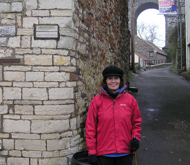
Image: © Rick Crowley Taken: 18 Feb 2009
The level is shown on the plaque on the wall top left. Part of Pensford viaduct is also shown. Bristol and North Somerset Railway, built the viaduct in 1873 but closed to trains in 1968 after the flood made it supposedly unsafe.
Images are licensed for reuse under creativecommons.org/licenses/by-sa/2.0
Image Location
Latitude
51.37205
Longitude
-2.551031