Former school, Monk Fryston
Introduction
The photograph on this page of Former school, Monk Fryston by Gordon Hatton as part of the Geograph project.
The Geograph project started in 2005 with the aim of publishing, organising and preserving representative images for every square kilometre of Great Britain, Ireland and the Isle of Man.

There are currently over 7.5m images from over 14,400 individuals and you can help contribute to the project by visiting https://www.geograph.org.uk
Former school, Monk Fryston
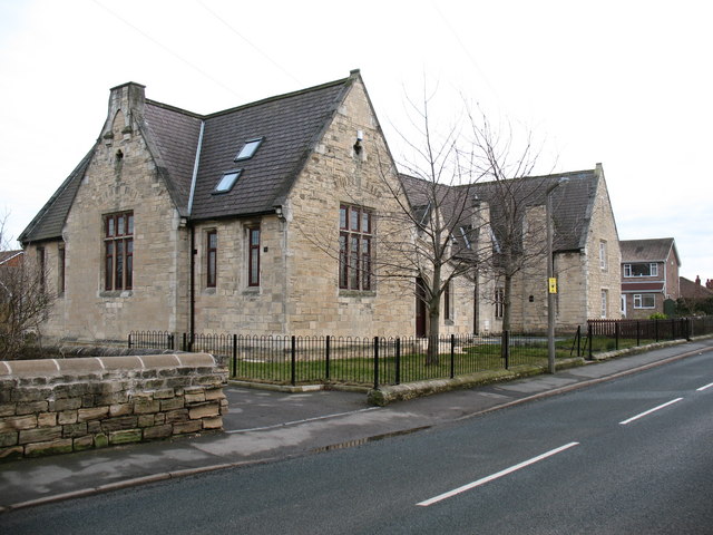
Image: © Gordon Hatton Taken: 17 Feb 2009
The original Victorian village school has been cleaned up and converted into houses. The new village school is just across the road.
Images are licensed for reuse under creativecommons.org/licenses/by-sa/2.0
Image Location
Latitude
53.759668
Longitude
-1.232458