Long view towards Goodwick and Pencaer
Introduction
The photograph on this page of Long view towards Goodwick and Pencaer by Natasha Ceridwen de Chroustchoff as part of the Geograph project.
The Geograph project started in 2005 with the aim of publishing, organising and preserving representative images for every square kilometre of Great Britain, Ireland and the Isle of Man.

There are currently over 7.5m images from over 14,400 individuals and you can help contribute to the project by visiting https://www.geograph.org.uk
Long view towards Goodwick and Pencaer
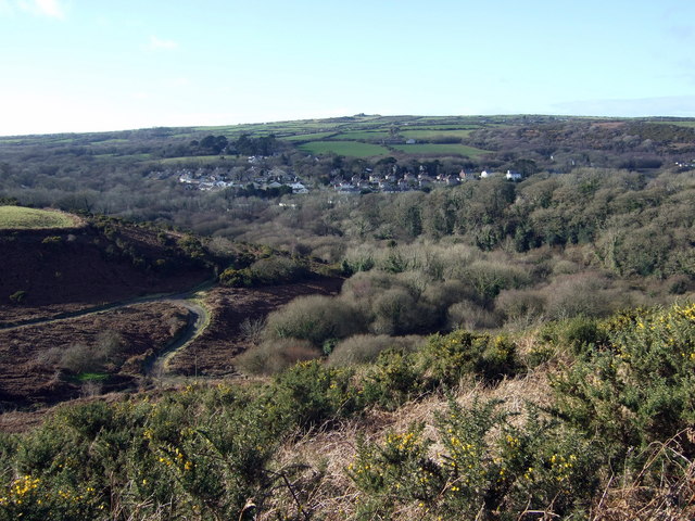
Image: © Natasha Ceridwen de Chroustchoff Taken: 11 Feb 2009
An exceptionally clear afternoon produces a remarkably long vista: in the foreground, the scrubby slope leading down to Cwm Brandy and, beyond the wooded area, the western part of Goodwick along the A487 St David's road. Above, just visible, are the farms of Trefwrgi (right) and Tre-Llewelyn (left, amongst dark trees), while the pimple on the skyline is the highest point on Pencaer, at 213 metres, the rocky peak of Garn Fawr on the west-facing coast.
Images are licensed for reuse under creativecommons.org/licenses/by-sa/2.0
Image Location
Latitude
51.995523
Longitude
-5.000165