Methold Houses, Beamish
Introduction
The photograph on this page of Methold Houses, Beamish by John Bedlington as part of the Geograph project.
The Geograph project started in 2005 with the aim of publishing, organising and preserving representative images for every square kilometre of Great Britain, Ireland and the Isle of Man.

There are currently over 7.5m images from over 14,400 individuals and you can help contribute to the project by visiting https://www.geograph.org.uk
Methold Houses, Beamish
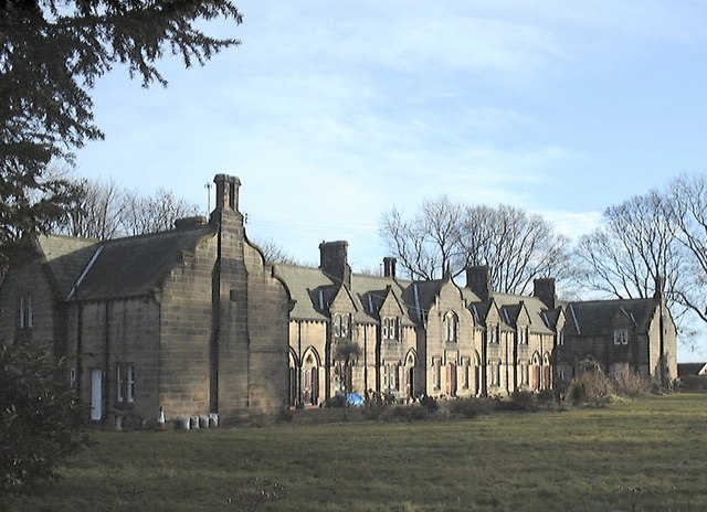
Image: © John Bedlington Taken: Unknown
Social Housing visible from the Shepherd & Shepherdess Pub. Erected c.1863 for John Eden the owner of the Beamish Estates at the time. Local folklore has it that the plan of the development is in the shape of an 'E' for his surname. Sandstone used extensively in construction.
Images are licensed for reuse under creativecommons.org/licenses/by-sa/2.0
Image Location
Latitude
54.878383
Longitude
-1.656161