View over Luton Part 2
Introduction
The photograph on this page of View over Luton Part 2 by Roland Pilcher as part of the Geograph project.
The Geograph project started in 2005 with the aim of publishing, organising and preserving representative images for every square kilometre of Great Britain, Ireland and the Isle of Man.

There are currently over 7.5m images from over 14,400 individuals and you can help contribute to the project by visiting https://www.geograph.org.uk
View over Luton Part 2
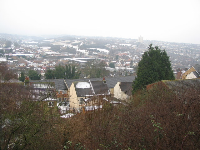
Image: © Roland Pilcher Taken: 5 Feb 2009
February 2009, exactly thirty years later, and a great deal has changed, even though there is once again snow on the ground. Trees and new housing on Beacon Road obscure the original vantage point. In order to get a view of the same scene a higher viewpoint was needed. This involved a scramble through thick scrub and in spite of the effort, the camera is still a bit to the left of its previous position. Pilchers coach yard has gone and been replaced by the Village View Estate. The trees in Church Terrace are taller and covered in Ivy. The Maidstone & District bus depot has gone and has been replaced by the Tramways Estate. The tram power station is now modern industrial units. It is mainly housing that provides continuity with the earlier view. The houses with mock tudor gables in Luton High Street are still there, just visible between the thick clumps of ivy, but of course the office block behind them has gone. The industrial buildings in Third Avenue can still be made out though they have changed colour somewhat. The Coney Banks have survived relatively unscathed.
Images are licensed for reuse under creativecommons.org/licenses/by-sa/2.0
Image Location


Leaflet Map data © OpenStreetMap
Latitude
51.370041
Longitude
0.546633