Changes on Orchard near Plackett's Hole
Introduction
The photograph on this page of Changes on Orchard near Plackett's Hole by David Anstiss as part of the Geograph project.
The Geograph project started in 2005 with the aim of publishing, organising and preserving representative images for every square kilometre of Great Britain, Ireland and the Isle of Man.

There are currently over 7.5m images from over 14,400 individuals and you can help contribute to the project by visiting https://www.geograph.org.uk
Changes on Orchard near Plackett's Hole
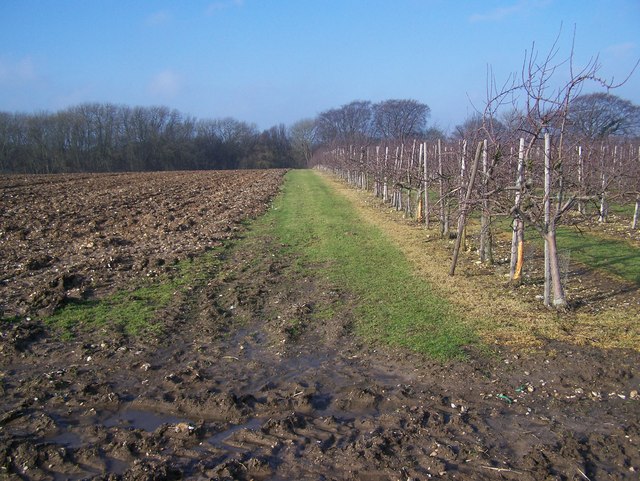
Image: © David Anstiss Taken: 29 Jan 2009
Two thirds of this plum orchard have been dug up, to grow a different crop. The footpath from Bicknor Lane to South Green Lane should go several metres to the left of this green edge to the orchard. In background is Church Wood.
Images are licensed for reuse under creativecommons.org/licenses/by-sa/2.0
Image Location
Latitude
51.302703
Longitude
0.670596