Pynes Hill Business Park
Introduction
The photograph on this page of Pynes Hill Business Park by Derek Harper as part of the Geograph project.
The Geograph project started in 2005 with the aim of publishing, organising and preserving representative images for every square kilometre of Great Britain, Ireland and the Isle of Man.

There are currently over 7.5m images from over 14,400 individuals and you can help contribute to the project by visiting https://www.geograph.org.uk
Pynes Hill Business Park
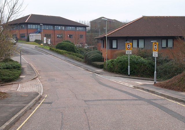
Image: © Derek Harper Taken: 31 Jan 2009
Pynes Hill crosses Ludwell Lane, an old lane leading down into the North Brook valley. The section of the lane to the left is closed to traffic. The signs on the right forbid traffic between 7 and 9 on weekday mornings. This complements the signs shown at the other end of the lane in Image The idea is clearly to make the lane one way during the rush hours (against the main flow of traffic), but the implication is that any other road user - a pedal cyclist or pedestrian, for instance - would not expect to meet any traffic between these times, which seems misleading.
Images are licensed for reuse under creativecommons.org/licenses/by-sa/2.0
Image Location
Latitude
50.710861
Longitude
-3.486096